Rainfall from the system that began overnight has become steady during the morning commute on Friday, Oct. 20.
There will be steady rain at times throughout the day Friday and Friday evening, and overnight into Saturday morning, Oct. 21.
Heavier downpours and rumbles of thunder are also possible, according to the National Weather Service.
Friday's high temperature will be in the low 60s.
Look for lingering showers on Saturday throughout the region with wind-swept rain for much of the day in New England.
Saturday's high temperature will be around 60 degrees.
A widespread inch-and-a-quarter of rainfall is expected from the Nor'easter in parts of northwest Connecticut, Western Massachusetts, and northern sections of Vermont, New Hampshire, and Maine could see up to 4 inches of rainfall.
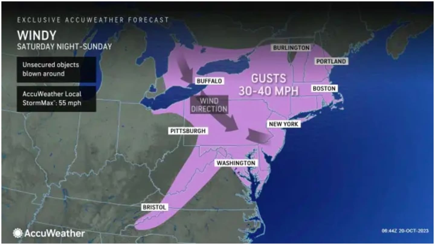
"The brunt of the storm will be delivered in New England and the Canadian Maritimes, but impacts will be felt elsewhere in the Northeast with some showers and gusty winds predicted," according to AccuWeather.com.
Those wind gusts will be as high as 40 miles per hour throughout the weekend. (See the image above.)
It will become partly sunny on Sunday, Oct. 22. The high temperature will be in the mid-50s but breezy conditions and strong wind gusts will make it feel cooler.
It will be sunny and pleasant on Monday, Oct. 23 with a high temperature in the upper 50s.
Check back to Daily Voice for updates.
Click here to follow Daily Voice Chappaqua and receive free news updates.